Category:PD MUTCD
Jump to navigation
Jump to search
To add an image to this category, add the {{PD-USGov-MUTCD}} template to its license section.
English:
The Manual on Uniform Traffic Control Devices (MUTCD) is a document issued by the Federal Highway Administration (FHWA) of the United States Department of Transportation (USDOT) to specify the standards by which traffic signs, road markings (see lane), and signals are designed, installed, and used. These specifications include the shapes, colors, and fonts used in road markings and signs. In the United States, all traffic control devices must generally conform to these standards. The manual is used by state and local agencies as well as private construction firms to ensure that the traffic control devices they use conform to the national standard. While some state agencies have developed their own set of standards, these must be in substantial conformance with the MUTCD.
The Manual on Uniform Traffic Control Devices (MUTCD) is a document issued by the Federal Highway Administration (FHWA) of the United States Department of Transportation (USDOT) to specify the standards by which traffic signs, road markings (see lane), and signals are designed, installed, and used. These specifications include the shapes, colors, and fonts used in road markings and signs. In the United States, all traffic control devices must generally conform to these standards. The manual is used by state and local agencies as well as private construction firms to ensure that the traffic control devices they use conform to the national standard. While some state agencies have developed their own set of standards, these must be in substantial conformance with the MUTCD.
According to the FWHA website, in addition to black and white, the following Pantone colors (with RGB equivalents) are to be used on signs:
- Brown - 469 (RGB 96,51,17 / Hex #603311) ; Red - 187 (175,30,45 / #af1e2d) ; Yellow - 116 (252,209,22 / #fcd116); Green - 342 (0,107,84 / #006b54) ; Blue - 294 (0,63,135 / #003f87) ; Orange - 152 (221,117,0 / #dd7500) ; Gold - 124 (224,170,15 / #e0aa0f) ; Cream - 468 (226,214,181 / #e2d6b5)
- See also Category:MUTCD Categories and the images in Category:Diagrams of road signs of the United States subcategories organized by states of the USA.
Subcategories
This category has the following 2 subcategories, out of 2 total.
- PD-Art (PD-MUTCD) (4 F)
Media in category "PD MUTCD"
The following 200 files are in this category, out of 25,175 total.
(previous page) (next page)-
"Mississippi Welcomes You" road sign (text only).png 703 × 249; 125 KB
-
"Mississippi Welcomes You" road sign (text only).svg 674 × 226; 17 KB
-
"Mississippi Welcomes You" state border welcome sign, c. October 2006.png 1,280 × 555; 661 KB
-
"Welcome to Delaware - Endless Discoveries" road sign, c. August 2017.png 1,253 × 856; 1,005 KB
-
1979 SHS M1-1.pdf 1,268 × 1,647; 842 KB
-
Air tansport.svg 1,277 × 710; 3 KB
-
Airport Sign.svg 608 × 613; 3 KB
-
Alabama 287.svg 750 × 600; 13 KB
-
Alachua County 10.svg 450 × 450; 13 KB
-
Alachua County 121A.svg 451 × 451; 13 KB
-
Alachua County 1469.svg 450 × 450; 14 KB
-
Alachua County 1471.svg 450 × 450; 14 KB
-
Alachua County 1474.svg 450 × 450; 13 KB
-
Alachua County 1491.svg 450 × 450; 14 KB
-
Alachua County 172.svg 450 × 450; 17 KB
-
Alachua County 200A.svg 451 × 451; 17 KB
-
Alachua County 2034.svg 450 × 450; 20 KB
-
Alachua County 2041.svg 450 × 450; 18 KB
-
Alachua County 2045.svg 450 × 450; 19 KB
-
Alachua County 2054.svg 450 × 450; 15 KB
-
Alachua County 2082.svg 450 × 450; 16 KB
-
Alachua County 2085.svg 450 × 450; 21 KB
-
Alachua County 214.svg 450 × 450; 16 KB
-
Alachua County 219.svg 450 × 450; 17 KB
-
Alachua County 219A.svg 450 × 450; 14 KB
-
Alachua County 220A.svg 450 × 450; 15 KB
-
Alachua County 222.svg 450 × 450; 18 KB
-
Alachua County 225.svg 450 × 450; 14 KB
-
Alachua County 225A.svg 450 × 450; 15 KB
-
Alachua County 227.svg 450 × 450; 14 KB
-
Alachua County 23.svg 450 × 450; 15 KB
-
Alachua County 231.svg 451 × 451; 16 KB
-
Alachua County 232.svg 450 × 450; 15 KB
-
Alachua County 235.svg 451 × 451; 16 KB
-
Alachua County 235A.svg 451 × 451; 16 KB
-
Alachua County 237.svg 450 × 450; 14 KB
-
Alachua County 239.svg 450 × 450; 14 KB
-
Alachua County 239A.svg 450 × 450; 15 KB
-
Alachua County 241.svg 450 × 450; 13 KB
-
Alachua County 243.svg 450 × 450; 14 KB
-
Alachua County 245.svg 450 × 450; 14 KB
-
Alachua County 253A.svg 450 × 450; 15 KB
-
Alachua County 25A.svg 451 × 451; 14 KB
-
Alachua County 25B.svg 451 × 451; 15 KB
-
Alachua County 26A.svg 450 × 450; 17 KB
-
Alachua County 27.svg 450 × 450; 14 KB
-
Alachua County 29.svg 450 × 450; 15 KB
-
Alachua County 30.svg 450 × 450; 15 KB
-
Alachua County 32.svg 450 × 450; 15 KB
-
Alachua County 325.svg 450 × 450; 12 KB
-
Alachua County 329.svg 450 × 450; 20 KB
-
Alachua County 3298.svg 450 × 450; 21 KB
-
Alachua County 337.svg 450 × 450; 20 KB
-
Alachua County 338.svg 450 × 450; 20 KB
-
Alachua County 340.svg 450 × 450; 14 KB
-
Alachua County 340A.svg 450 × 450; 15 KB
-
Alachua County 346.svg 450 × 450; 14 KB
-
Alachua County 346A.svg 450 × 450; 18 KB
-
Alachua County Road 231 FL.svg 450 × 450; 14 KB
-
Alachua County Road 235A FL.svg 450 × 450; 15 KB
-
Alachua County Road 25A FL.svg 450 × 450; 14 KB
-
Albany County 103 wide.svg 750 × 600; 15 KB
-
Albany County 156 wide.svg 750 × 600; 15 KB
-
Albany County 157 wide.svg 750 × 600; 13 KB
-
Albany County 351 wide.svg 750 × 600; 13 KB
-
Albany County 353 wide.svg 750 × 600; 14 KB
-
Albany County Route 234 WY.svg 450 × 450; 17 KB
-
Albany County Route 30 WY.svg 450 × 450; 17 KB
-
Albany County Route 57 WY.svg 450 × 450; 12 KB
-
Albany County Route 59 WY.svg 450 × 450; 16 KB
-
Alcona County F-30.svg 450 × 450; 18 KB
-
Alcona County F-32.svg 450 × 450; 18 KB
-
Alcona County F-41.svg 450 × 450; 14 KB
-
Alger County H-01.svg 450 × 450; 15 KB
-
Alger County H-03.svg 450 × 450; 17 KB
-
Alger County H-05.svg 450 × 450; 16 KB
-
Alger County H-09.svg 450 × 450; 16 KB
-
Alger County H-11.svg 450 × 450; 13 KB
-
Alger County H-13.svg 450 × 450; 15 KB
-
Alger County H-15.svg 449 × 450; 69 KB
-
Alger County H-44.svg 450 × 450; 13 KB
-
Alger County H-52.svg 450 × 450; 16 KB
-
Alger County H-58.svg 450 × 450; 16 KB
-
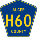
Alger County H-60.svg 450 × 450; 17 KB
-
Allegan County A-2.svg 450 × 450; 14 KB
-
Allegan County A-37.svg 450 × 450; 15 KB
-
Allegan County A-42.svg 450 × 450; 14 KB
-
Allegan County A-45.svg 450 × 450; 14 KB
-
Allegany County 15B.svg 451 × 451; 10 KB
-
Allegany County 20.svg 451 × 451; 11 KB
-
Alt plate 1961.svg 600 × 226; 767 bytes
-
Alt plate blue 1961.svg 600 × 226; 1 KB
-
Alt plate brown.svg 601 × 301; 661 bytes
-
Alt plate green 1961.svg 600 × 226; 1 KB
-
Alt plate green.svg 601 × 301; 1 KB
-
Alt plate GSP.svg 600 × 300; 674 bytes
-
Alt plate HCTRA.svg 601 × 301; 653 bytes
-
Alt plate orange.svg 600 × 300; 775 bytes
-
Alt plate South Dakota.svg 601 × 301; 793 bytes
-
Alt plate Wyoming.svg 600 × 300; 773 bytes
-
Alt truck plate.svg 601 × 602; 6 KB
-
Alternate business plate.svg 601 × 602; 4 KB
-
Alternate plate (es).svg 601 × 301; 2 KB
-
Alternate plate 1926.svg 600 × 201; 3 KB
-
Alternate plate 1935.svg 600 × 201; 3 KB
-
Alternate plate 1948.svg 600 × 226; 4 KB
-
Alternate plate blue (es).svg 601 × 301; 2 KB
-
Alternate plate blue 1961.svg 600 × 226; 2 KB
-
Alternate plate brown.svg 601 × 301; 2 KB
-
Alternate plate county (es).svg 600 × 300; 2 KB
-
Alternate plate green 1961.svg 600 × 226; 2 KB
-
Alternate plate GSP.svg 600 × 300; 2 KB
-
Alternate plate HCTRA.svg 600 × 300; 2 KB
-
Alternate plate orange.svg 600 × 300; 2 KB
-
Alternate plate South Carolina.svg 601 × 301; 2 KB
-
Alternate plate South Dakota.svg 601 × 301; 2 KB
-
Alternate plate Wyoming.svg 600 × 300; 2 KB
-
Alternate truck plate.svg 601 × 602; 5 KB
-
Antrim County C-38.svg 450 × 450; 17 KB
-
Antrim County C-42.svg 450 × 450; 15 KB
-
Antrim County C-48.svg 450 × 450; 15 KB
-
Antrim County C-65.svg 450 × 450; 16 KB
-
Antrim County C-73.svg 450 × 450; 15 KB
-
Appanoose County Route J18 IA.svg 450 × 450; 23 KB
-
Appanoose County Route J29 IA.svg 450 × 450; 24 KB
-
Appanoose County Route S70 IA.svg 450 × 450; 25 KB
-
Appanoose County Route T20 IA.svg 450 × 450; 24 KB
-
Appanoose County Route T30 IA.svg 450 × 450; 24 KB
-
Arkansas 00 1926.svg 600 × 558; 18 KB
-
Arkansas 00 1948.svg 400 × 372; 15 KB
-
Arkansas 1.svg 600 × 600; 2 KB
-
Arkansas 133 1948.svg 400 × 372; 19 KB
-
Assistive Listening Devices 1.JPG 900 × 900; 38 KB
-
Assistive Listening Devices 2.JPG 900 × 900; 38 KB
-
Atlantic County 561.svg 451 × 451; 10 KB
-
Atlantic County 585.svg 451 × 451; 11 KB
-
Atlantic County 601.svg 450 × 450; 16 KB
-
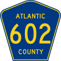
Atlantic County 602.svg 450 × 450; 18 KB
-
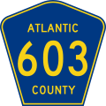
Atlantic County 603.svg 450 × 450; 18 KB
-
Atlantic County 604.svg 450 × 450; 16 KB
-
Atlantic County 605.svg 450 × 450; 17 KB
-
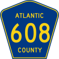
Atlantic County 608.svg 450 × 450; 19 KB
-
Atlantic County 610.svg 450 × 450; 16 KB
-
Atlantic County 611.svg 450 × 450; 14 KB
-
Atlantic County 612.svg 450 × 450; 16 KB
-
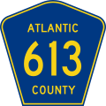
Atlantic County 613.svg 450 × 450; 16 KB
-
Atlantic County 614.svg 450 × 450; 14 KB
-
Atlantic County 615.svg 450 × 450; 15 KB
-
Atlantic County 616.svg 450 × 450; 15 KB
-
Atlantic County 617.svg 450 × 450; 14 KB
-
Atlantic County 618.svg 450 × 450; 16 KB
-
Atlantic County 619.svg 450 × 450; 15 KB
-
Atlantic County 620.svg 450 × 450; 18 KB
-
Atlantic County 622.svg 450 × 450; 18 KB
-
Atlantic County 623.svg 450 × 450; 18 KB
-
Atlantic County 624.svg 450 × 450; 16 KB
-
Atlantic County 627.svg 450 × 450; 16 KB
-
Atlantic County 629.svg 450 × 450; 17 KB
-
Atlantic County 630.svg 450 × 450; 18 KB
-
Atlantic County 631.svg 450 × 450; 16 KB
-
Atlantic County 633.svg 450 × 450; 18 KB
-
Atlantic County 634.svg 450 × 450; 16 KB
-
Atlantic County 637.svg 450 × 450; 17 KB
-
Atlantic County 638.svg 450 × 450; 19 KB
-
Atlantic County 640.svg 450 × 450; 16 KB
-
Atlantic County 643.svg 450 × 450; 16 KB
-
Atlantic County 644.svg 450 × 450; 14 KB
-
Atlantic County 645.svg 450 × 450; 16 KB
-
Atlantic County 646.svg 450 × 450; 16 KB
-
Atlantic County 647.svg 450 × 450; 16 KB
-
Atlantic County 648.svg 450 × 450; 16 KB
-
Atlantic County 649.svg 450 × 450; 16 KB
-
Atlantic County 650.svg 450 × 450; 17 KB
-
Atlantic County 651.svg 450 × 450; 15 KB
-
Atlantic County 652.svg 450 × 450; 17 KB
-
Atlantic County 654.svg 450 × 450; 15 KB
-
Atlantic County 655.svg 450 × 450; 16 KB
-
Atlantic County 657.svg 450 × 450; 16 KB
-
Atlantic County 658.svg 450 × 450; 17 KB
-
Atlantic County 659.svg 450 × 450; 16 KB
-
Atlantic County 660.svg 450 × 450; 17 KB
-
Atlantic County 661.svg 450 × 450; 15 KB
-
Atlantic County 662.svg 450 × 450; 17 KB
-
Atlantic County 663.svg 450 × 450; 17 KB
-
Atlantic County 665.svg 450 × 450; 18 KB
-
Atlantic County 666.svg 450 × 450; 18 KB
-
Atlantic County 668.svg 450 × 450; 18 KB
-
Atlantic County 669.svg 450 × 450; 18 KB
-
Atlantic County 670.svg 450 × 450; 18 KB
-
Atlantic County 671.svg 450 × 450; 16 KB
-
Atlantic County 672.svg 450 × 450; 16 KB
-
Atlantic County 674.svg 450 × 450; 14 KB
-
Atlantic County 678.svg 450 × 450; 17 KB
-
Atlantic County 679.svg 450 × 450; 16 KB
-
Atlantic County 680.svg 450 × 450; 18 KB
-
Atlantic County 681.svg 450 × 450; 16 KB
-
Atlantic County 682.svg 450 × 450; 18 KB
-
Atlantic County 684.svg 450 × 450; 16 KB
-
Atlantic County 685.svg 450 × 450; 17 KB
-
Atlantic County 686.svg 450 × 450; 17 KB































.svg/120px-Alternate_plate_(es).svg.png)
.svg/120px-Alternate_plate_blue_(es).svg.png)

.svg/120px-Alternate_plate_county_(es).svg.png)


