Category:Maps of Kyrgyzstan
Jump to navigation
Jump to search
Countries of Asia: Afghanistan · Armenia‡ · Azerbaijan‡ · Bahrain · Bangladesh · Bhutan · Brunei · Cambodia · China · Cyprus‡ · East Timor · Egypt‡ · Georgia‡ · India · Indonesia‡ · Iran · Iraq · Israel · Japan · Jordan · Kazakhstan‡ · Kuwait · Kyrgyzstan · Laos · Lebanon · Malaysia · Maldives · Mongolia · Myanmar · Nepal · North Korea · Oman · Pakistan · Philippines · Qatar · Russia‡ · Saudi Arabia · Singapore · South Korea · Sri Lanka · Syria · Tajikistan · Thailand · Turkey‡ · Turkmenistan · United Arab Emirates · Uzbekistan · Vietnam · Yemen
Other territories: Abkhazia‡ · Akrotiri and Dhekelia‡ · Republic of Artsakh‡ · British Indian Ocean Territory · Hong Kong · Macau · Northern Cyprus‡ · State of Palestine · South Ossetia‡ · Taiwan
‡: partly located in Asia
Other territories: Abkhazia‡ · Akrotiri and Dhekelia‡ · Republic of Artsakh‡ · British Indian Ocean Territory · Hong Kong · Macau · Northern Cyprus‡ · State of Palestine · South Ossetia‡ · Taiwan
‡: partly located in Asia
Wikimedia category | |||||
| Upload media | |||||
| Instance of | |||||
|---|---|---|---|---|---|
| Category combines topics | |||||
 | |||||
Subcategories
This category has the following 23 subcategories, out of 23 total.
!
- OpenStreetMap maps of Kyrgyzstan (37 F)
B
- Maps of borders of Kyrgyzstan (10 F)
- Maps of Bishkek (6 F)
- Blank maps of Kyrgyzstan (5 F)
C
D
E
F
- Flag maps of Kyrgystan (5 F)
L
- Location maps of Kyrgyzstan (6 F)
M
- Maps of Tian Shan (7 F)
S
T
W
Pages in category "Maps of Kyrgyzstan"
The following 2 pages are in this category, out of 2 total.
Media in category "Maps of Kyrgyzstan"
The following 56 files are in this category, out of 56 total.
-
450px-Kyrgyzstan regions2Russian.png 450 × 181; 53 KB
-
Batken conflict in Kyrgyzstan in 1999.png 6,456 × 3,264; 874 KB
-
China-Russia border - protocol of Chuguchak 1864.jpg 935 × 900; 674 KB
-
Distribution of Anthemis ruthenica (triangles) in Kyrgyzstan.jpg 1,024 × 756; 188 KB
-
Fergana valley topo political.png 375 × 178; 136 KB
-
FLII Kyrgyzstan.png 1,688 × 826; 251 KB
-
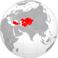
Independent-Turkic-States-Kyrgyzstan-2010.png 1,278 × 473; 98 KB
-
Inylchek.png 1,294 × 654; 1.94 MB
-
KG-Ysyk-Kol-Tup.png 2,000 × 556; 1.47 MB
-
Kigriz ASSR in 1927.jpg 1,200 × 642; 72 KB
-
Kirgisien topo.png 1,010 × 650; 1.1 MB
-
Kirgiz ASSR 1967.jpg 323 × 172; 9 KB
-
Kizilsu Kirghiz Autonomous Prefecture.jpg 1,333 × 750; 459 KB
-
Koppen-Geiger Map KGZ present.svg 1,769 × 850; 769 KB
-
Kyrgyz Khanate map.jpg 1,256 × 796; 353 KB
-
Kyrgyz-Republic GHI Solar-resource-map GlobalSolarAtlas World-Bank-Esmap-Solargis.png 1,842 × 1,443; 1.71 MB
-
Kyrgyzjer.png 1,601 × 1,025; 679 KB
-
Kyrgyzstan districts numbered.png 1,598 × 1,022; 24 KB
-
Kyrgyzstan provinces map ru.png 750 × 423; 28 KB
-
Kyrgyzstan raions.png 1,598 × 1,022; 16 KB
-
Kyrgyzstan Regions Map (4 Regions).png 2,832 × 1,699; 1.13 MB
-
Kyrgyzstan w2 locator.svg 1,000 × 1,000; 252 KB
-
Kyrgyzstanmaplocator.gif 633 × 321; 17 KB
-
Location map of Temen-Suu, Kyrgyzstan.svg 744 × 694; 43 KB
-
Manas Air Base in Kyrgyzstan.png 432 × 292; 123 KB
-
Map of Birinchi May district.png 482 × 419; 25 KB
-
Map of independent Turkic countries..png 4,500 × 2,234; 257 KB
-
Map of Independent Turkic countries.svg 550 × 550; 571 KB
-
Map of Karategin-Kyrgyz Confederation.jpg 1,080 × 879; 143 KB
-
Oirat-map-ru.png 2,566 × 2,324; 145 KB
-
Outline map of Chuy Province on the map of Kyrgyzstan.svg 806 × 419; 65 KB
-
PAT - Kyrgyzstan.gif 1,090 × 800; 378 KB
-
Population density of Kyrgyzstan regions.png 5,343 × 3,211; 508 KB
-
Ridges of Kyrgyzstan.jpg 4,818 × 2,651; 894 KB
-
Shakemap, 2008 Kyrgyzstan earthquake.jpg 612 × 720; 143 KB
-
Siedlungsgebiete der Kirgisen.PNG 1,270 × 685; 39 KB
-
Sultanate’s of Bugu Tribe map.jpg 1,363 × 733; 281 KB
-
Tagai Confederation map.png 1,080 × 1,080; 544 KB
-
Tajiks in Kyrgyzstan.png 1,598 × 1,022; 100 KB
-
Universitätsstädte Kirgisistan.jpg 400 × 239; 46 KB
-
USSR map NK 43-10 Andizhan.jpg 5,000 × 3,781; 4.4 MB
-
USSR map NK 43-9 Imeni Voroshilova.jpg 5,000 × 3,784; 4.86 MB
-
West-Kyrgyz confederation map.jpg 1,256 × 796; 326 KB
-
Yenisei Kyrgyz Khaganate.png 514 × 403; 49 KB
-
Борбордук Азия (XX кылымдын башында).svg 658 × 536; 144 KB
-
БорбордукАзия1922.svg 1,066 × 869; 50 KB
-
Кыргыз АССР (аймактар 1926-1928).png 1,079 × 790; 342 KB
-
Кыргыз Республикасы.png 900 × 454; 115 KB
-
Таджики в Киргизии (по областям).png 1,920 × 1,087; 175 KB


_in_Kyrgyzstan.jpg/120px-Distribution_of_Anthemis_ruthenica_(triangles)_in_Kyrgyzstan.jpg)


.png/120px-Kyrgyzstan_Regions_Map_(4_Regions).png)


.svg/120px-Борбордук_Азия_(XX_кылымдын_башында).svg.png)

.png/120px-Кыргыз_АССР_(аймактар_1926-1928).png)

.png/120px-Таджики_в_Киргизии_(по_областям).png)