Category:Geography of Japan
Jump to navigation
Jump to search
landforms and water bodies in the state of Japan | |||||
| Upload media | |||||
| Pronunciation audio | |||||
|---|---|---|---|---|---|
| Instance of |
| ||||
| Subclass of | |||||
| Facet of | |||||
| Location |
| ||||
| Said to be the same as | Japanese archipelago | ||||
| |||||
Subcategories
This category has the following 26 subcategories, out of 26 total.
*
+
.
C
E
G
L
M
P
T
W
Y
Media in category "Geography of Japan"
The following 18 files are in this category, out of 18 total.
-
1953renminribao.png 647 × 574; 144 KB
-
Chirihyo.jpg 1,516 × 2,284; 243 KB
-
Chirinouryoku.logo.jpg 325 × 84; 13 KB
-
Concept of cultural stratigraphy by Saito, I.png 1,735 × 832; 102 KB
-
Flussverlauf Nishikigawa.png 2,338 × 1,653; 5.33 MB
-
Geography of Otsuka to Tsukuba.jpg 2,304 × 1,728; 1.76 MB
-
J-VIS gate E.svg 549 × 363; 32 KB
-
Japan main islands.png 235 × 300; 7 KB
-
Japan Map Chikei.gif 700 × 530; 142 KB
-
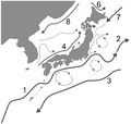
Japan's ocean currents.PNG 714 × 680; 65 KB
-
JapanCitiesTownsOMC.PNG 1,965 × 1,866; 227 KB
-
Japanese Islands.png 1,313 × 1,350; 79 KB
-
Jinbunchiri.jpg 1,631 × 2,471; 305 KB
-
Kokon-shoin ver April 2012.JPG 1,640 × 2,304; 831 KB
-
Pass over Southeastern Asia (2).ogv 21 s, 840 × 560; 3.53 MB
-
Projet Japon.jpg 500 × 135; 33 KB
-
जापान की भौगोलिक समीक्षा.djvu 871 × 1,500, 379 pages; 85.2 MB
-
日本経緯度原点.jpg 4,032 × 3,024; 3.88 MB


