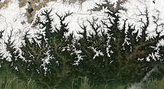
Category:Geography of Bhutan
Jump to navigation
Jump to search
| Upload media | |||||
| Instance of |
| ||||
|---|---|---|---|---|---|
| Facet of | |||||
| Location |
| ||||
 | |||||
Subcategories
This category has the following 11 subcategories, out of 11 total.
*
- Satellite pictures of Bhutan (105 F)
C
- Climate diagrams of Bhutan (1 F)
G
L
- Landscapes of Bhutan (12 F)
M
P
T
W
Media in category "Geography of Bhutan"
The following 8 files are in this category, out of 8 total.
-
Bhutan physical map.svg 427 × 273; 468 KB
-
Bhutan STITCH 3762-1.jpg 8,560 × 2,790; 4.16 MB
-
Bhutan topo en.jpg 1,200 × 909; 321 KB
-
Bhutan topo.jpg 1,200 × 909; 321 KB
-
Mebartsho.jpg 768 × 576; 178 KB
-
Natt i Bhutan.LW.jpg 4,288 × 2,848; 3.86 MB
-
Wv Punakha banner.jpg 6,848 × 981; 1.16 MB
-
Zizi village in Phobjikha.jpg 2,048 × 1,536; 619 KB


